
What’s going on around the station ?” The Google Maps Street View function, which allows you to see your surroundings at 360° while moving on the map, is helpful in such cases. So today, in this article, we will explain how to use Google street view.
Quick Answer: Open Google Map> Enter Location on search bar>open location> Click thumbnail with the Streetview icon.
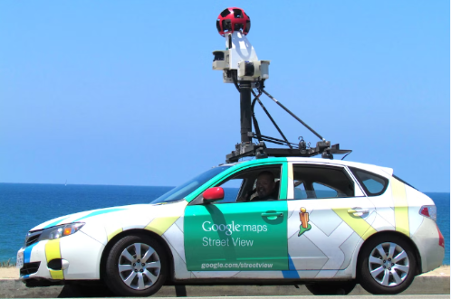
Have you seen a car with a 360-degree camera attached to the roof of the car? They are just gathering videos(for better user experience) and photos for Google street views.
◆ How to use Google street view on Mobile and PC?
Since you can see places worldwide, many of you must have used Street View to find the spots you want to visit. In addition to stations (including subways) and airports, it has expanded to indoor restaurants and entertainment facilities and the area seen in Street View is gradually expanding.
There are several ways to use Google Maps Street View on your smartphone (iPhone/Android smartphone), but we will introduce how to use the most popular Google Maps app.
The convenient point of the Google Maps app is that you can use both route search and street view.
The iOS version application is verified and explained, but the operation method is the same for the Android version application.
How do I enable Google street view on my phone?
Before going to open Streetview, you must enable Street View. Follow steps:
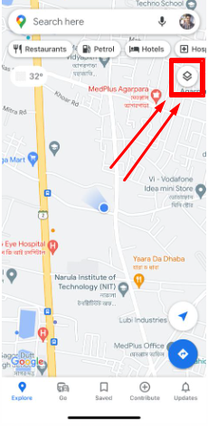
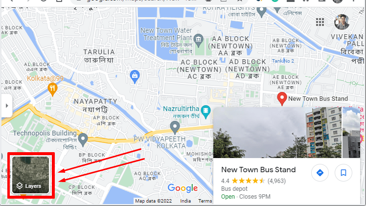
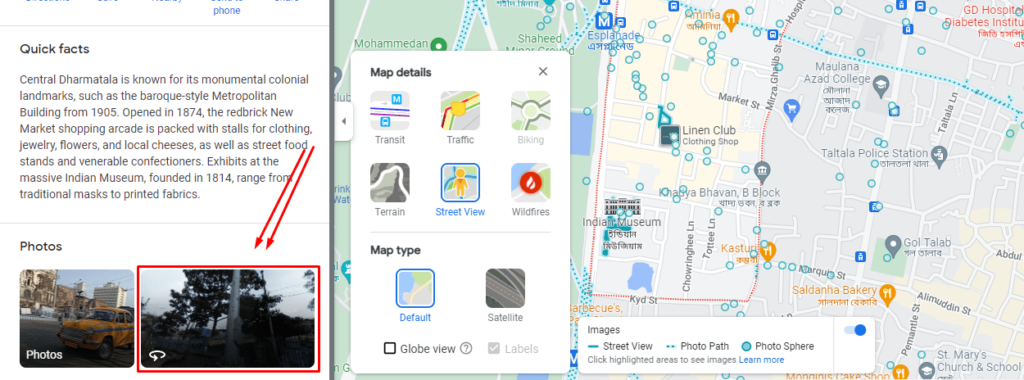
1. Open the google map on your device and click on the Layer(Follow image).
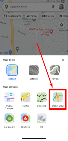
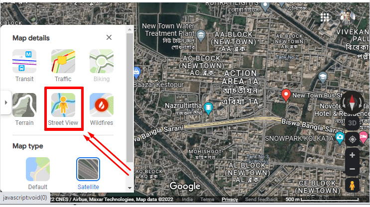
2. Now, tap on the Street View; it’s done.
How to use Google street view on iPhone?
First of all, you have to download Google map from your App store, after that follow these steps:
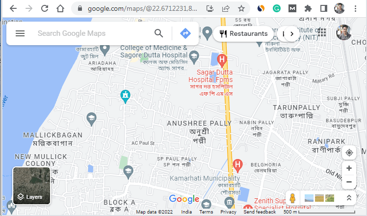
1. Open your google map,
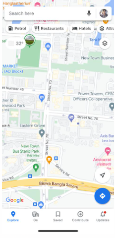
2. Then enter a location on the search bar,
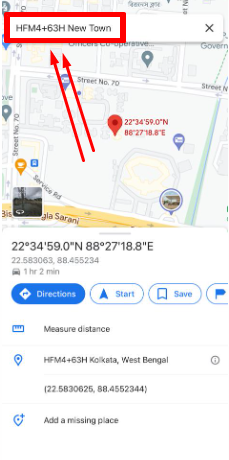
3. Now you can see your Location opened on your map,
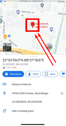
4. Now select the thumbnail with the Street view icon.
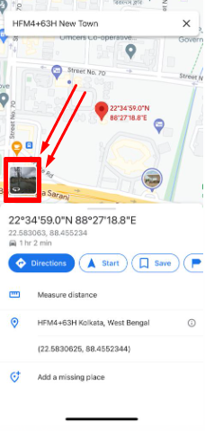
5. You can move the photos where you want.
Yes, it’s done; you can use it as easily. Before searching anything, make sure your device is connected to the internet.
How to use Google street view on a PC?
I’m not using google street view on my pc, but I know how to do it; being a tech guy, it’s very easy to use for me. Let’s follow the steps:
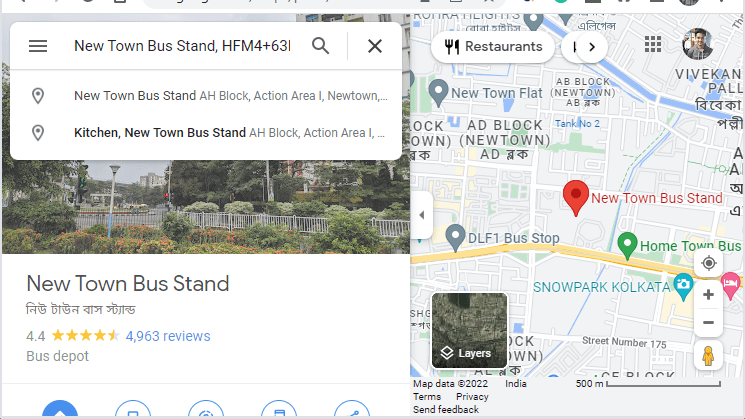
1. Open google map on your PC,
2. Enter the Location on the search bar,
3. After the Location opens, click on the layer from the bottom left.
4. Now select the “Street View,”
5. Click on Photo with the Street view icon.
While you’re in Street View, you can look around by clicking and dragging your mouse, or if you’re using the laptop, you can look around by clicking on your touch pad.
How can I see my house on Google Street View?
Go to the search box on Google Maps and enter your home address. Now, click your address from the search results. Google Earth will fly you to your neighborhood. Drag the Pegman icon to close a look at your home.
If you’re doing this from the United States, then you can see a clear view of your home. But in a country like India, you can’t see a cleare view of your home.
How to Blur my House on Google Maps?
- Open the google map and navigate to your home,
- Drag the Street View icon to the road beside your house and Focus the view on your property
- In the bottom right corner, click Report a problem
- Now, adjust the Image preview,
- Under Why are you reporting this image, use the Request blurringtool,
- To blur the house, select My home and provide additional information to support blurring,
- With the reason provided, enter your Email address andSubmit it.
Why are Some Houses Blurred Out on Google Maps?
There are multiple reasons behind it, but the main three reasons are:
- Your landlord may be decided to blur the house,
- Your neighbor has blurred their property, and it is not done accurately,
- May google have some bugs when they submit those images and videos?
You can fix it within a few days by contacting Google Maps. Google map has the option to fix this issue. Before doing this stuff, you need to confirm whether anyone played a prank on you or not; if yes, it will be solved automatically.
◆ FAQs
Q.1. What is Google Maps Street View?
Ans: Google Maps Street View is one of the functions of “Google Maps” and “Google Earth,” and it is a service that allows you to see a 360° panoramic image of a point specified on the map as if you were there.
In addition to images taken by Street View shooting vehicles with cameras and photographers traveling around the country, you can also see images posted by the general public. Compared to aerial photographs taken from the sky, the terrain can be examined more Three-dimensionally. However, the footage should not be real-time but should be taken within the past 1-3 years.
Q.2. How to see indoor images using Google street video?
Ans: There are also facilities where you can see indoor images.Indoor Street View may also be available at some facilities. Search for the facility name and swipe up on the detailed information display of the facility. Tap Street View and 360°.
If you don’t have Street View and 360° view, tap the photo with the Street View icon. By tapping the image with the street view icon in the lower left, you can look around the facility in the street view.
Q.3. Is there a dedicated Street View app available?
Ans:Google Maps also offers a dedicated app, “Google Street View,” specializing in street view. Easy access to all “Street View” photos, including images taken by Google and user-submitted images.
By entering a location in the search window at the app’s top screen, you can see the same street view as the Google Maps app and panorama photos posted by other users.
You can also share and publish photos on your profile. You can add photos, such as when you discover a place with little image information. Recommended for those who want to enjoy “Street View” more deeply.
I’m sourav, from Kolkata. A tech lover and love to answer any tech-related queries. I just try answering all questions like my problem.